
This is a brief summary of my last paper: Sevil, J., Gutiérrez, F. (2024). Temporal variability of sinkhole hazard illustrated in the western shore of the Dead Sea. Natural Hazards, 1-15. Open Access. https://doi.org/10.1007/s11069-024-06708-9
Despite the increasing economic and societal damage related to sinkhole activity worldwide, quantitative sinkhole hazard assessments are scarce. This can be attributed to the difficulties to compile complete sinkhole inventories and the common lack of chronological data. These limitations may lead to minimum hazard estimates and the presumption that the probability of occurrence of sinkhole remains steady over time, which may not be true and could result in costly hazard over- or under-estimations.
In this regard, the extraordinarily high frequency of sinkhole occurrence in the eogenetic salt karst of the Dead Sea coast has allowed us to explore for the first time in the scientific literature the temporal variability of sinkhole hazard parameters.
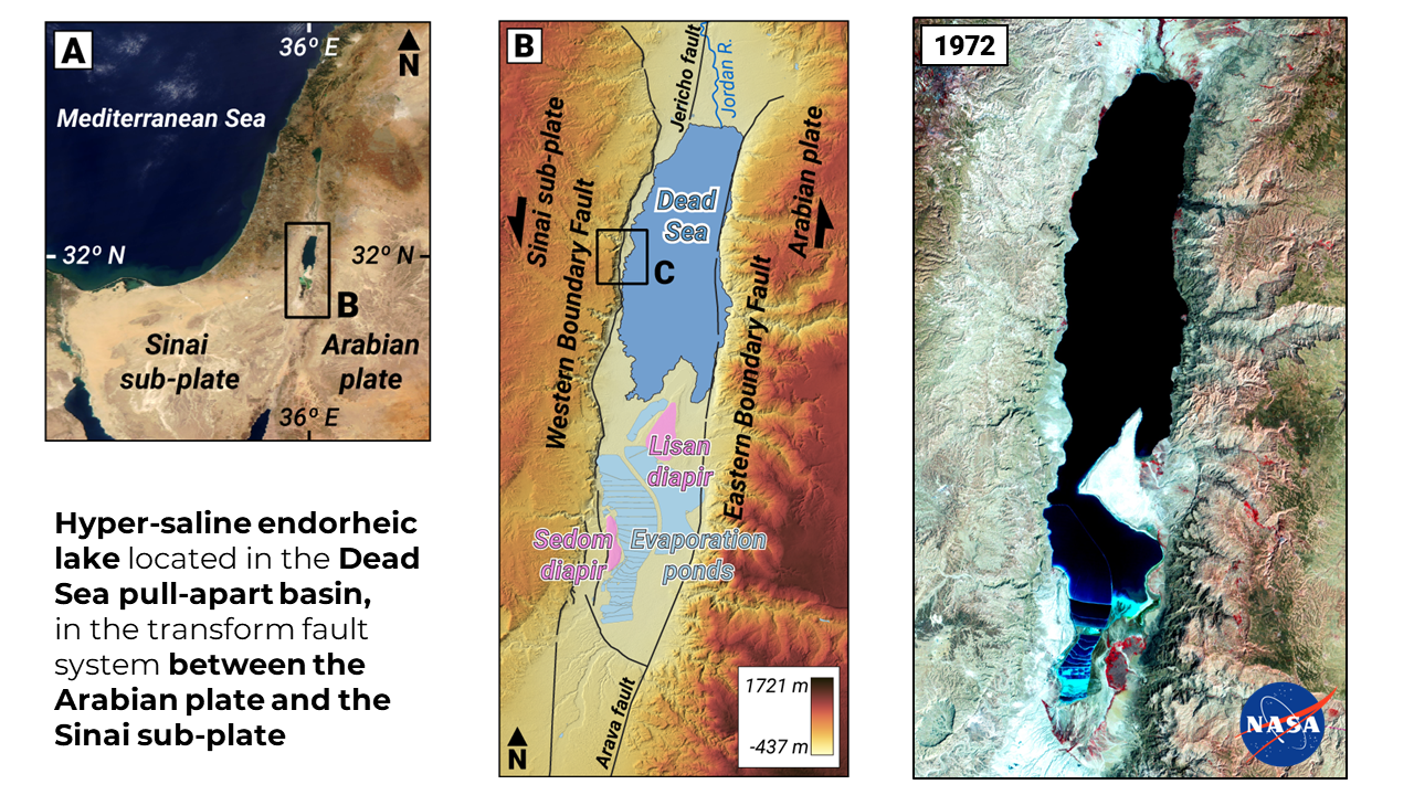
As you already probably know, in addition to being the lowest land-based elevation on Earth, the Dead Sea is a hyper-saline endorheic lake located in one the pull-apart basins developed in the transform fault system between the Arabian plate and the Sinai sub-plate.
Currently, this basin is divided in two and separated by the Lisan diapir. The southern one used to be flooded by the Dead Sea but nowadays it is occupied by industrial evaporation ponds for potash production. As you can see on the right image above, in 1972 both basins were connected.
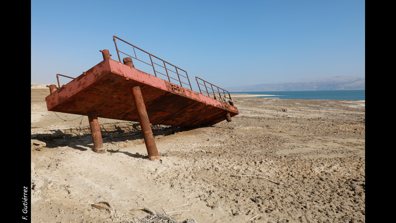
What happened here? The Dead Sea lake level has been declining for over a century mainly because of the increment of use of water in the catchment and its pumping to the southern evaporation ponds.
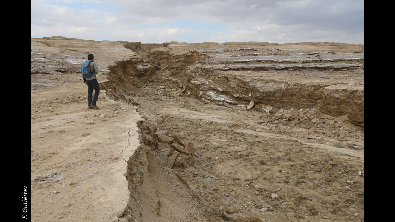
This anthropogenic retreat of the shoreline and the accompanying base-level drop have induced and enhanced a number of hazardous geomorphic processes such as fluvial downcutting, mass wasting processes, and subsidence.
The most striking geomorphic effect has been the generation of thousands of sinkholes. Since the 80s, the decline of the Dead Sea lake level has been accompanied by the formation of more than 6000 sinkholes in the coast of the lake.
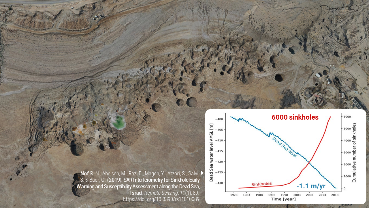
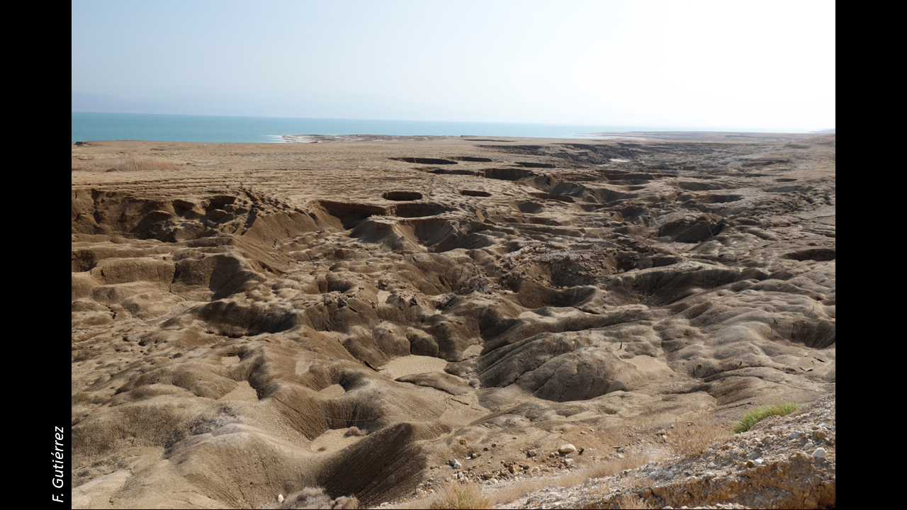
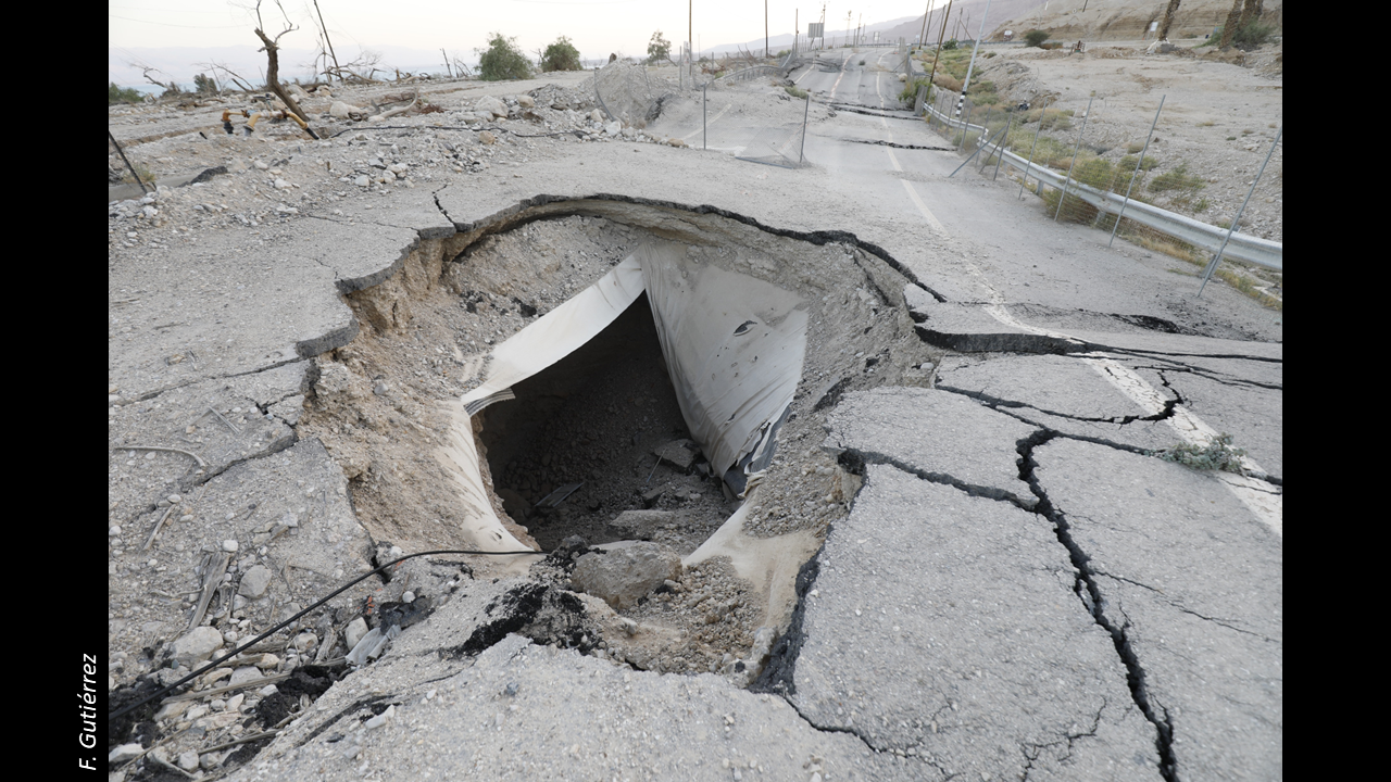
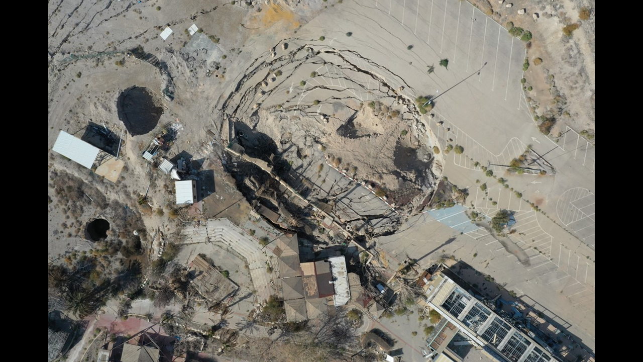
These sinkholes have completely changed the landscape and resulted in substantial damage on human structures such as roads or touristic resorts.
Before describing some of the results we obtained in our study area on the western coast of the Dead Sea… Why do sinkholes form here?
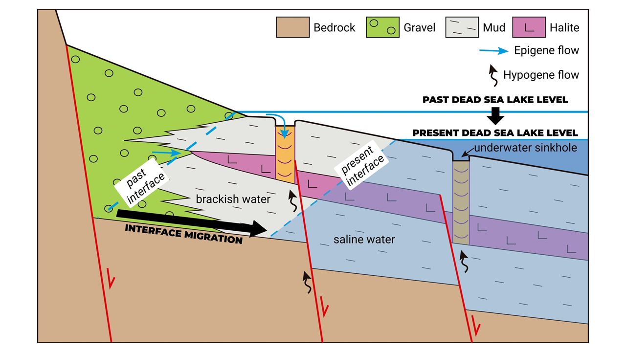
According to borehole data, around 20m below the surface there is a salt layer up to 25m thick and mainly composed of halite crystals. The dissolution of this unit creates the accommodation space that can reach the surface as sinkholes, most of the time as collapses.
According to the most accepted hypothesis, the lake level drop causes the lateral lakeward migration of the interface between the brackish and saline water. This allows subsaturated water to interact with and dissolve the salt layer that used to be in equilibrium.
There are three main compatible models that explain the dissolution of the salt unit by undersaturated water that reaches the salt. One hypogenic model and two epigenic ones:
From deep bedrock aquifers flowing upwards along concealed faults that reach the halite and that have been detected by geophysics.
From laterally interfingered alluvial gravels that allow subsaturated water to dissolve the halite unit from its edge.
Percolating via sinkholes that function as swallow holes during flash floods.
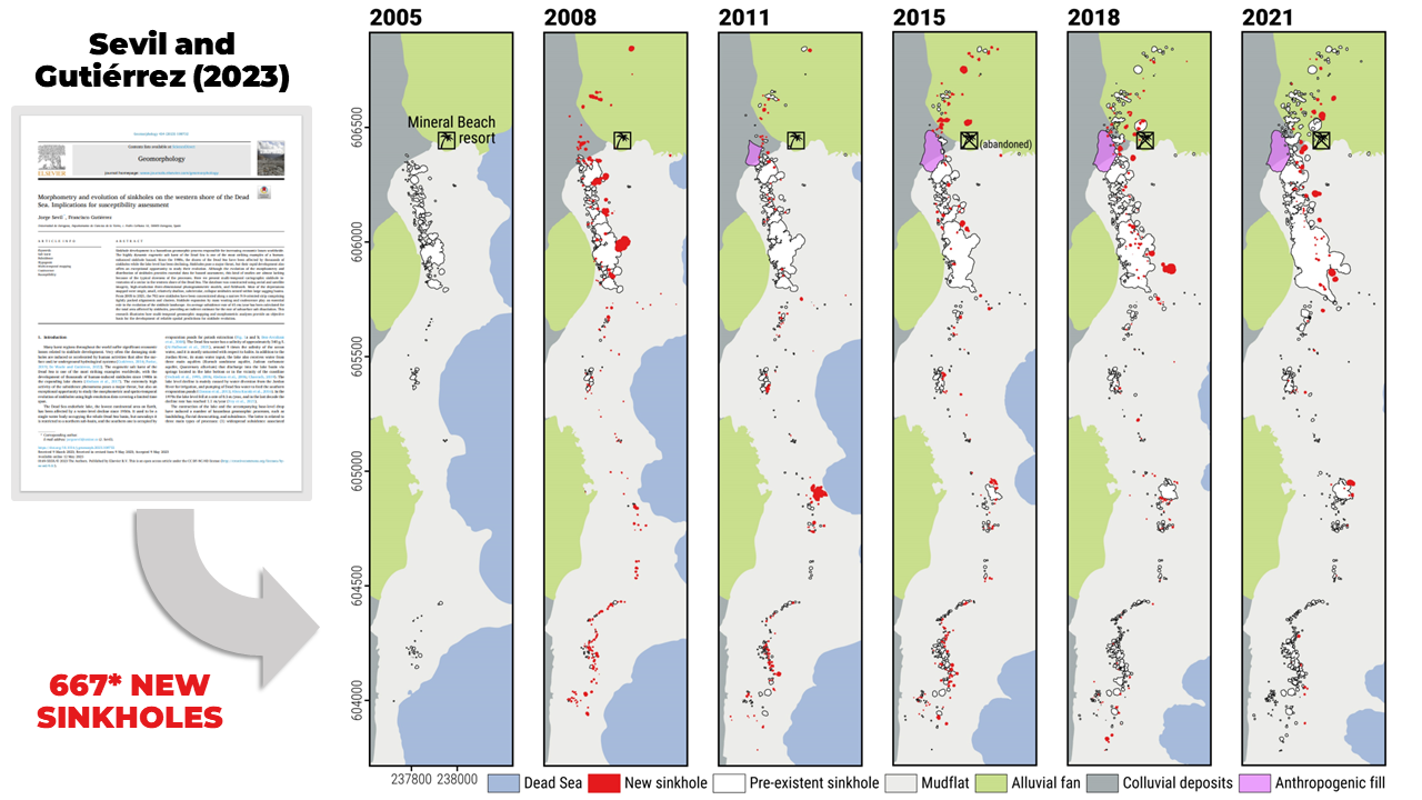
Now that we better understand what is going on. How did we study the potential temporal variability of sinkhole hazard? By means of multi-temporal mapping. We produced sinkholes maps every 3 years from 2005 to 2021 using aerial photographs, satellite images, and drone-derived orthoimages. The major general findings on the morphometry and evolution of the studied area are described in a paper that was published last year (Sevil and Gutiérrez, 2023: https://doi.org/10.1016/j.geomorph.2023.108732).
However, for this study we only focused on the sinkholes mapped for the first time each year. These are the new sinkholes, in red. Additionally, we used only single sinkholes, filtering out the compound ones formed by coalescence between sinkholes over the studied period.
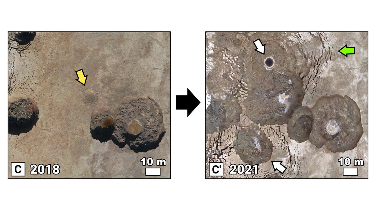
It is important to note that because of the high density of sinkholes, the high rate of occurrence, and the fast expansion of their margins (green arrow), the coalesce of sinkholes and the formation of compound ones is a common phenomenon.
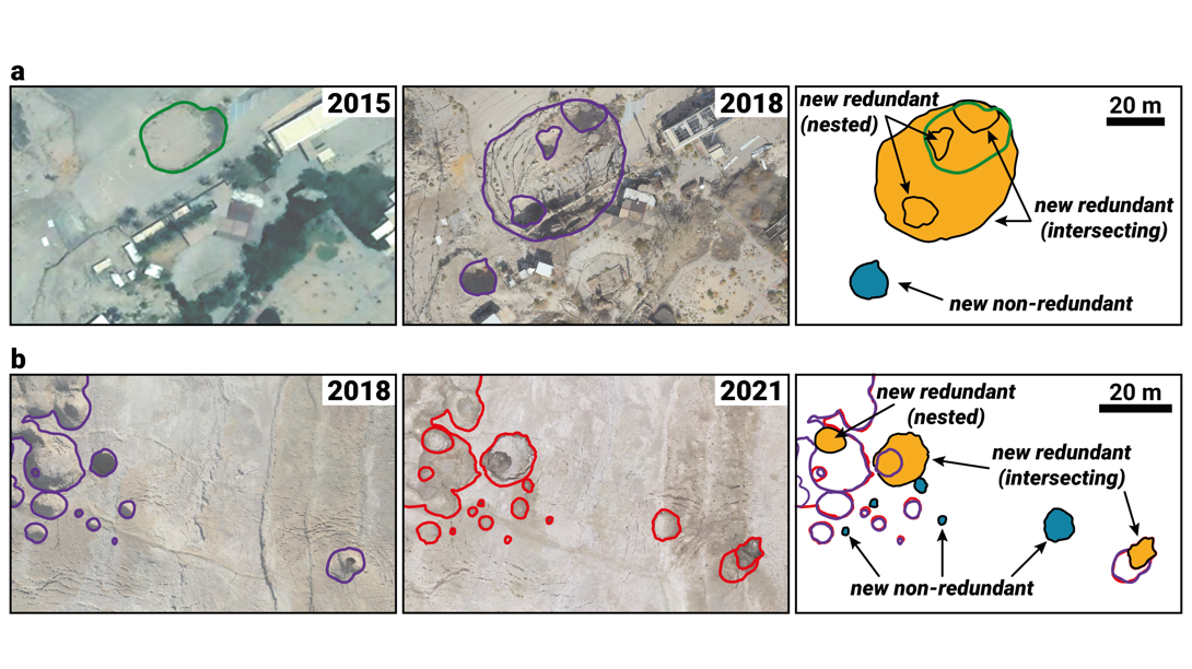
Moreover, as the size and density of sinkholes increases, the spatial redundancy grows as well. Which means that the number of sinkholes formed within or intersecting pre-existent ones increases with time. This affects sinkhole hazard because not all the new sinkholes will create new subsiding area.
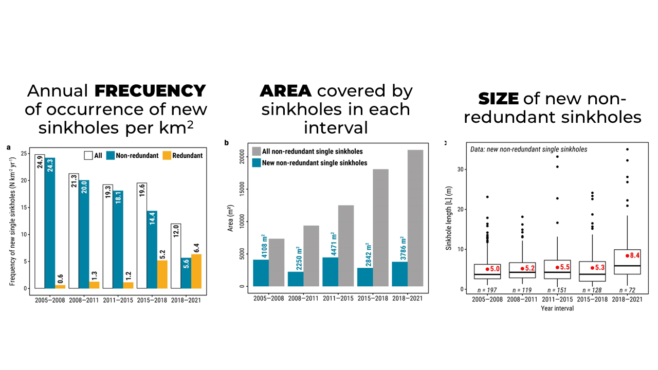
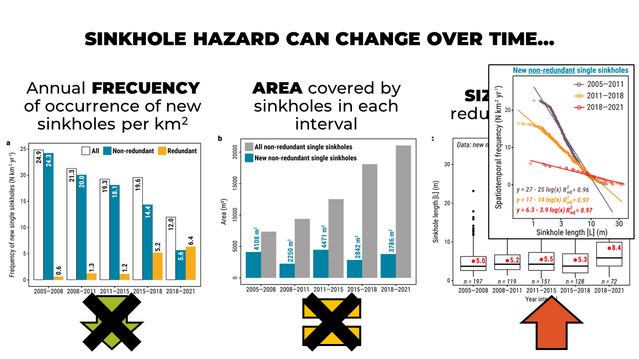
With all the information gathered in the multi-temporal maps we could assess (1) the annual frequency of occurrence of new sinkholes per km2, in white all the new single sinkholes, in blue only the non-redundant, and in yellow the redundant ones -which as I have explained increase with time; (2) the area covered by sinkholes in each interval, in grey all non-redundant single sinkholes and in blue just the new ones; and (3) the size of new non-redundant sinkholes.
The main result we obtained was that sinkhole hazard can change over time and that the frequency-size relationships of different hazard components may display contrasting evolution.
For example, in the same study area over the same period:
Regarding the frequency of generation of new sinkholes, regardless of their size, sinkhole hazard showed a decreasing pattern.
However, the new area affected by new non-redundant sinkholes each year interval displayed little variation. Which suggests a rather constant hazard level.
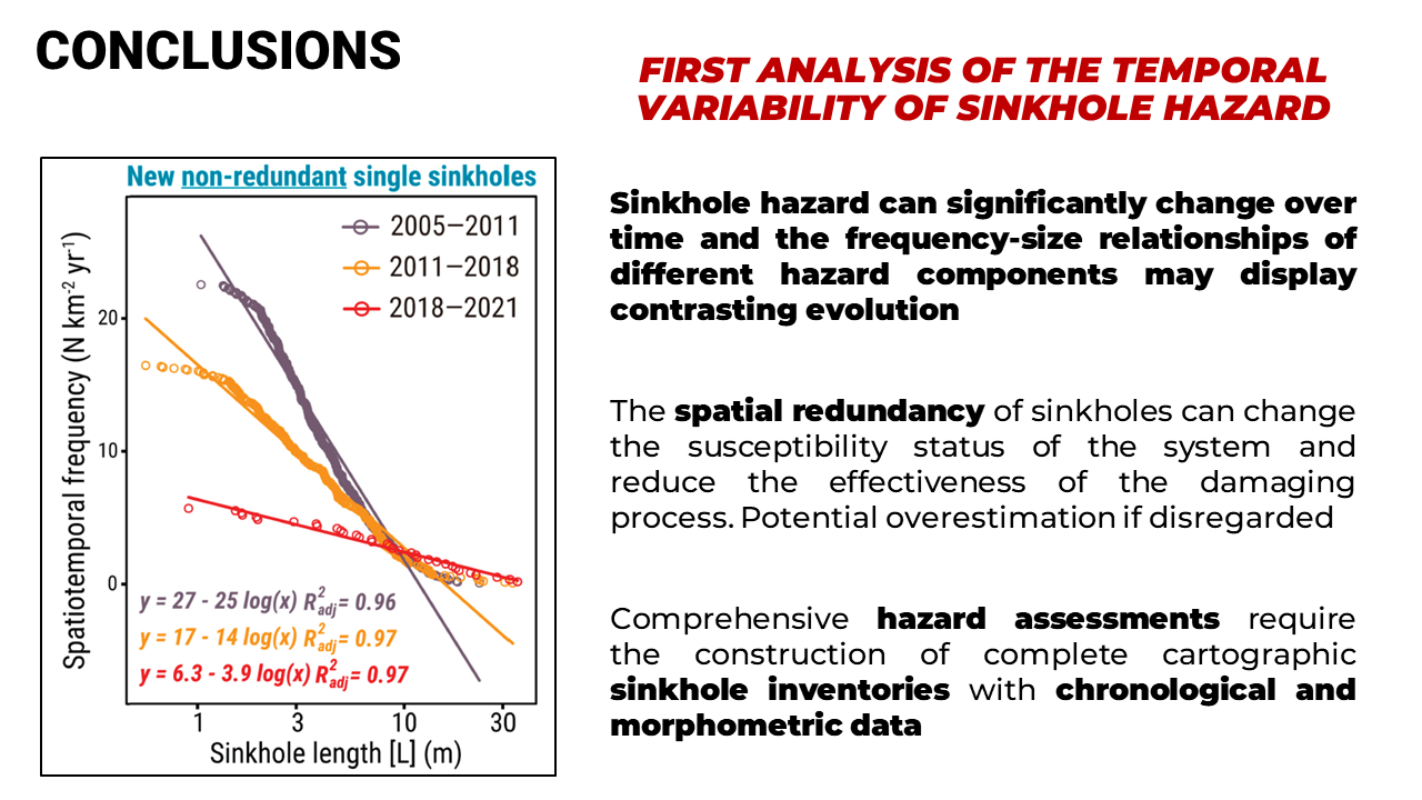
This apparent contradiction is related to the occurrence of progressively larger sinkholes. In fact, not only we identified an increase of the mean, in red, and maximum sinkhole sizes, but also the hazard curves, which compare the size of the major axes of new sinkholes with their spatiotemporal frequency over consecutive periods, revealed a relative increase of the larger sinkholes. This means a hazard and severity increment that had gone unnoticed for simpler analyses and that could cause severe consequences.
Finally, the main conclusions of our study, which is the first analysis of the temporal variability of sinkholes hazard published in the scientific literature, are:
Muchas gracias por vuestro tiempo.
Jorge